



Neptune Americo-Septentrional Contenant les Côtes, Îles et Bancs, les Baies, Ports, et Mouillages, et les Sondes des Mers de cette partie du Monde, depuis le Groenland inclusivement, jusques et compris le Golfe du Mexique avec les îles de Sous-le-vent et du Vent, accompagné de Plans particuliers des Ports les flus fréquentés. Ou Recueil de cartes hydrographiques à l'usage des Vaißeaux du Roi, Rédigé d'après les Cartes Françoises et Etrangeres les plus estimées; Rectifié d'après des Plans Manuscrits authentiques, et aßujetti aux Observations astronomiques Dreßé au Dépôt Général des Cartes, Plans et Journaux de la Marine, et publié par ordre du Roi
SARTINE’S AMERICAN COASTAL ATLAS AT THE DAWN OF INDEPENDENCE
EX-COLL. DEPÔT DE LA MARINE, DESCOTES, RABUT & de LAVIS-TRAFFORD
[Paris: Dépôt des Cartes, 1778–1780.] First edition.
Broadsheet folio (25 7/16” x 19 5/8”, 646mm x 499mm): with an engraved title-page and 26 engraved charts, of which 5 (two of the Atlantic coast, Boston, Chesapeake, Hilton Head) are double-page.
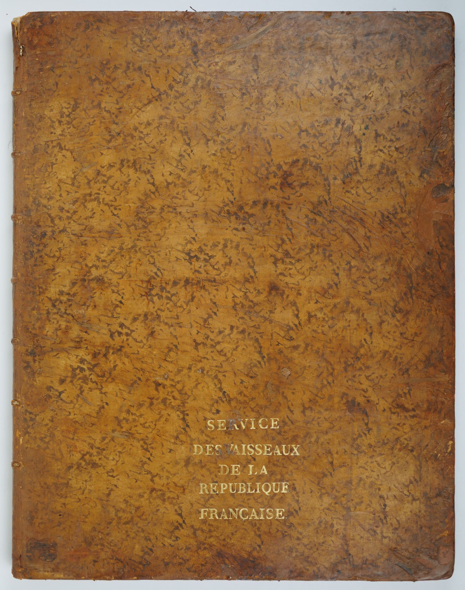
Bound in contemporary mottled calf. On the front board, “SERVICE/ DES VAISSEAUX/ DE LA/ REPUBLIQUE/ FRANÇAISE” gilt. On the spine, seven raised bands. Title (“NEPTUNE/AMERICO”) gilt to red sheep in the second panel. In the panels, anchors and fleurons alternating gilt.
Heavy bump to the head, with splits. Strengthened at the head and tail, with some infill at the upper edge of the rear cover. Some cracking and loss to the edges. Title-page laid down (at an early date?). Foxing to the “Plan du port de Chibouctou” and “Plan du port de la revière St Jean” (eleventh and twelfth maps). Damp-stain to the lower edge throughout, particularly toward the spine, mostly avoiding the image. Abrasions (affecting the scale) to the final chart (“Carte réduite… de la Floride”), repaired verso with the booklabel of M.A. de Lavis Trafford. Bookplate of “Fr. Rabut. Cambs” to the front paste-down. Bookplates of “Eligii Descotes, Sacerdotis” and of M.A. de Lavis Trafford (“Villa Lavis| Beaulieu-sur-Mer| France.| T. 81/1” to the title-page, with the latter repeated at the verso of the final map-sheet.
After the British defeat at Saratoga 17 October 1777, it became clear to the powers of the world that the cause of American Independence had a material chance of success. Less than a month later, the Continental Congress ratified “The United States of America” as the name of the newborn nation, and, a month later the French — in a major blow to their longtime British rival — recognized the name and the diplomatic independence of the revolutionary state. By 6 February 1778, the Treaty of Alliance was signed between France and the Second Continental Congress, formalizing the French support of the revolutionary government in America and spurring both military support as well as the French cartographic interest in the region.
Antoine de Sartine, comte d’Alby (1729–1801), Secretary of State of the Navy (successor to the duc de Choiseul who had done so much to revive the institution after its failures in the 1760’s), was the great modernizer and innovator of the French Navy. He instituted a more rational naval force, with control over coasts and the building of sea defenses, as well as the institution of shipboard hygiene regimes that did much to control persistent issues of sailors’ health. He also organized for the review and updating of the extant French charts (or, where needed, new surveying) related to North America, the product of which — in the grand tradition of the Neptune François and Neptune Oriental — was the present North-American “Neptune,” i.e., the maritime equivalent of an Atlas.
It is no overstatement that French involvement, and particularly naval support, was crucial to the success of the American Revolution. A longtime hatred of the British and a desire to reverse the defeats of the Seven Years’ War brought the French into the war, and Sartine rose to the challenge of increasing the number of ships available — and suppling them with the best cartographic support —to that end. Twelve of the charts depict coastal Canada, with special focus on Acadia, including Nova Scotia, twelve depict the United States, beginning in Maine and ending (although Burden’s order of maps interrupts the Canadian section with the maps of Louisiana and Florida, bizarrely, as [3] and [4]) in Florida — one of the most desirable XVIIIc separate maps of the whole peninsula.
The supralibros specifying that the volume was for the “service of the vessels of the French Republic” indicates that the Neptune was still in official use as late as 1792 and perhaps well after. The alternating figures of anchors and fleurons (sometimes fleurs-de-lys, though in the republican period it is understandable that more neutral flowers should be used) often decorate the spines of the Dêpot’s books; altogether strong evidence that this was the volume (or one of them) used by the makers of the Neptune themselves.
The bookplate of “Eligius Descotes, Sacerdotis” is, rather confusingly, that of Anne François Marie Joseph Eloi (latinized to Eligius) Descostes (Descôtes, 1846–1908), a conservative Catholic politician and historian from Savoy. He was president of Savoy Académie des sciences, belles-lettres et arts 1900-1908. Descostes doubtless acquired the book in preparation for his 1897 La Révolution Française vue de l’Étranger 1789-1799. Perhaps he gave it to François Rabut (1819–1913), professor of history at Chambéry (the prefecture of Savoy), as well as an archaeologist and curator of that city’s natural history museum. Dr. Marc-Antoine (or Marcus) de Lavis-Trafford (1880–1960) was a medical doctor by training but active as a Roman archaeologist, who published extensively on Hannibal’s route through the Alps. He was a pioneer of Alpine sports as well as physician to the Duke of Connaught, Queen Victoria’s favorite child.
Howes N 52; Phillips, Atlases 1211; Sabin 52337.
Item #JLR0640
Price: $68,000